Folds, Faults, Tafoni, a Ghost Forest, and a Dinosaur!
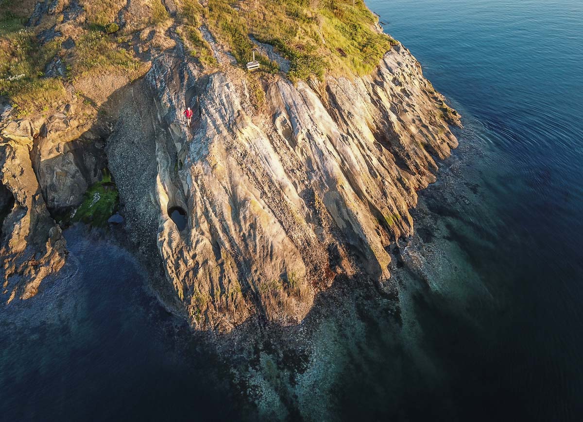
What a lot of variety packed into less than a square mile of rock! Sucia Island has many features that delight anyone interested in the natural environment. For runners and hikers, an extensive network of trails leads the curious to all of these features. Also, at low tide much detail can be seen by walking (safely!) portions of the shoreline. Let’s briefly describe some of the most noteworthy geologic features.
The Rock
Except for the bedrock ridge making up the southwest portion of the island, bedrock here is made of sedimentary rock named the Chuckanut Formation for similar rock found on Chuckanut Mountain near Bellingham. The rock is mostly sandstone but in places siltstone and conglomerate are interlayered, telling a story of an ancient meandering river system existing about 50 million years ago that deposited sand, silt, and pebbles. Plant fossils are abundant, including fossilized wood, and sparse evidence of terrestrial animals has been found, mostly tracks. The fossil assemblage suggests a humid subtropical climate during the time of deposition, quite different than today’s local climate.
Fossil Bay was the site of quarrying of sandstone over a century ago. The massive blocks were barged to Seattle for paving stone. You can see the remains of the quarry near the dock in Fossil Bay.
The oldest bedrock on Sucia is the Nanaimo Group, making up Little Sucia Island, the ridge south of Fox Cove and along the south shore of Fossil Bay. Siltstone is the dominant rock type and it contains abundant fossils of invertebrate marine organisms such as clams, snails, and ammonites. At low tide you can easily walk along the marine terrace , a product of wave erosion, until a cliffed shoreline blocks progress. The rock on the high cliff is completely unsuitable for climbing, being finely fractured, soft, and unstable.
The Nanaimo rocks are at least 75 million years old and evidence indicates they were transported as much as 1000 miles from their depositonal origin by plate tectonics. How? Glad you asked! The evidence is complex but centers on the latitude of formation of rock of similar age on the mainland dated by paleomagnetism.
The surface of the entire island shows clear evidence of being overridden by glaciers. Rocks include abundant light-colored granite pebbles, cobbles, and boulders, as well as various other rocks such as quartzite and greenstone not local to the San Juan Islands. These rocks originated in the mainland of British Columbia where they are found as bedrock. Transported by moving glaciers, the rocks were dumped when the ice melted here about 10-12,000 years ago. Maximum elevation of similar boulders on the mainland indicates that at maximum continental glaciers in the area of the present-day Salish Sea were over one mile thick!
The Fault
If you walk along the north shore of Fox Cove at low tide, you might notice the light gray rock making up the low backshore cliff just above high tide level. Look closely and you might see some “S” shaped folds in the bedrock. This is evidence of the Fox Cove fault, which brings into contact the 50 million year old Chuckanut Formation with the 75 million year old Nanaimo Group. The actual contact is not exposed, but the younger rock sliding over the older Nanaimo deformed the rock near the fault contact zone into these folds.
Plunging Syncline
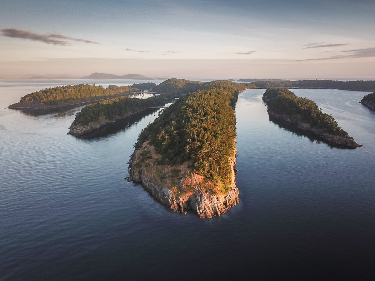
Glancing at a map you’ll see that Sucia Island is shaped like a horseshoe that is seeking to be hooked on an imaginary post somewhere to the southeast. What’s going on here with this unusually shaped island?
The parallel ridges, elongated smaller islands, and intervening valleys and embayments are all part of a structure called a syncline. At the same time that the Fox Cove fault was breaking rock, the sedimentary rock layers of the Chuckanut Formation were being deformed when they were beneath Earth’s surface. Synclines form ‘troughs’ where bent layers are inclined (dipping) toward a centerline, which in this case is plunging (passively ‘diving’) toward the southeast. The ridges are more resistant rock (sandstone) and the lower ‘valleys’ between are the less resistant rock (siltstone).
Tafoni and Honeycomb Weathering
Many places along the island’s shoreline show a “honeycomb” structure in bedrock, and along the central shore of Shallow Bay there are large (washtub to bathtub size) cave-like cavities. The later are tafoni (Italian)and are weathering features. To develop they require permeable rock, salt, and repeated cycles of wetting and drying. When saltwater splashed on the rock dries , tiny salt crystals form and wedge the sand grains apart. The sides of cavities are more shaded and are damper, inhibiting crystal formation, so the rear of a cavity deepens with time. Multiple cavities can overlap and produce bigger cavities. Large tafoni in the central east shore of Shallow Bay are often called the China Caves and allegedly were involved in smuggling operations long ago.
The Dinosaur!
In 2014 a fossilized bone was found in the Nanaimo rocks near Ev Henry Point at the southeast end of Fossil Bay. This was identified as a part of the left femur of a theropod dinosaur, the same category of reptile that includes T-rex and velociraptors.
This is the first and only dinosaur fossil yet found in Washington! Clam shell fossils found within the hollow part of the bone prove that the skeletal remains of a land-dwelling dinosaur washed into the ocean.
“Ghost Forest”
Just inland near the south shore of Shallow Bay you will notice a number of standing dead cedar trees…a “ghost forest.” What caused the trees in this grove to die?
Hypotheses included 1) an earthquake causing subsidence and subsequent flooding, and 2) flooding from either a tsunami or large storm waves led to salt water intrusion that killed the trees.
But recent (2008) information tells the real story. Early homesteaders blocked the natural outlet of the small stream in the area because they desired a reliable source of surface fresh water in the pond they created. The flooding killed the trees….. less dramatic but true.
While on Sucia, be sure to read the information on the kiosk up the path near Fossil Bay dock. It contains much of the preceding information including pictures. The geology panel was prepared by George Mustoe, a former classmate of this writer and a noted authority on both Sucia Island and Chuckanut Formation geology.
An important note is that it is illegal to collect natural materials in state parks, including rocks, fossils, and plants. Take only pictures and memories, leave only footprints!
Prepared by Doug McKeever
Geology professor (emeritus), Whatcom Community College, Bellingham
